Commercial Roof Inspection Support
Aerial inspection support captured across a multi-level commercial property in Newport city centre to assist rapid roof condition assessment and visual review.
The project focused on providing organised high-resolution imagery across multiple roof areas to support surveyor review within a constrained urban environment where traditional access would have been significantly more disruptive, time-consuming and costly.
Project Overview
This project involved aerial inspection support for a large commercial property positioned within a busy high street environment in Newport city centre.
The building presented multiple roof levels, restricted visibility from ground level and challenging access conditions to both the front and rear elevations. Traditional inspection access methods would likely have required additional planning, traffic or pedestrian considerations and potentially temporary access equipment to safely review all roof areas effectively.
Using a structured aerial approach, the inspection focused on capturing clear visual references across separate roof sections, including roof coverings, drainage systems, flashing, parapet details, chimney condition, rooftop plant equipment and wider signs of deterioration or water ingress risk.
Imagery was organised into clearly labelled roof areas to simplify review and support efficient assessment by the surveyor team.
Project Type
Inspection support
Environment
Commercial city centre property
Outputs
Organised inspection imagery
Status
Completed inspection
Deliverables & Outputs
The project focused on providing clear, organised aerial imagery to support rapid review of multiple roof areas across the property.
Separate roof sections were documented individually to simplify navigation and assessment, allowing the surveyor team to review imagery efficiently without unnecessary complexity or excessive file organisation.
Additional close-range imagery was captured where visible deterioration or areas of concern required further visual reference, helping provide broader context across the condition of the building envelope.
Outputs Delivered
- High-resolution roof inspection imagery
- Organised folder structure by roof area
- Annotated roof reference overview
- Close-range defect visibility imagery
- Overall site overview capture
- Visual references for surveyor assessment
Project Visuals
Selected aerial inspection imagery captured to support visual assessment across multiple roof areas within a constrained commercial environment.
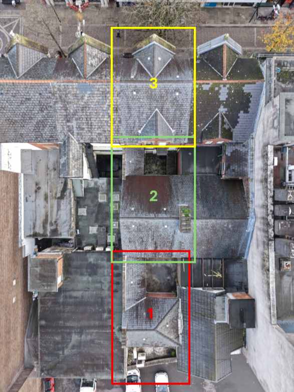
Annotated roof overview used to organise inspection imagery across multiple roof areas and simplify review workflow.
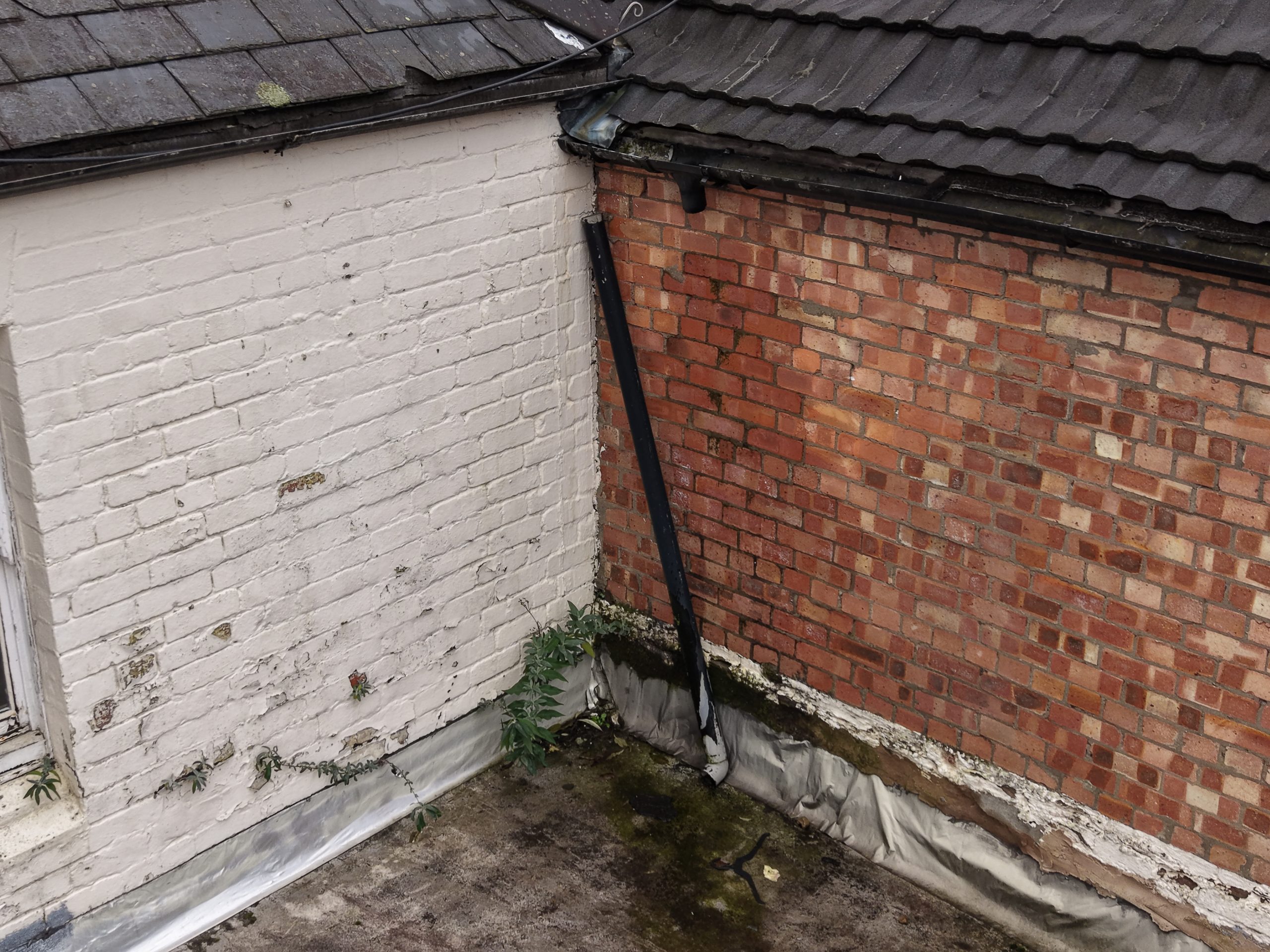
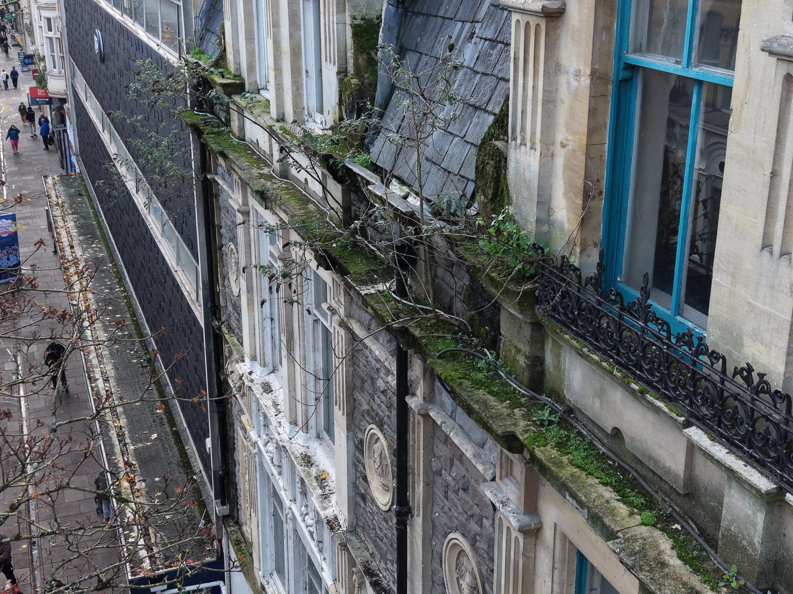
Close-range aerial imagery highlighting visible deterioration, drainage issues and aging materials across restricted-access roof areas.
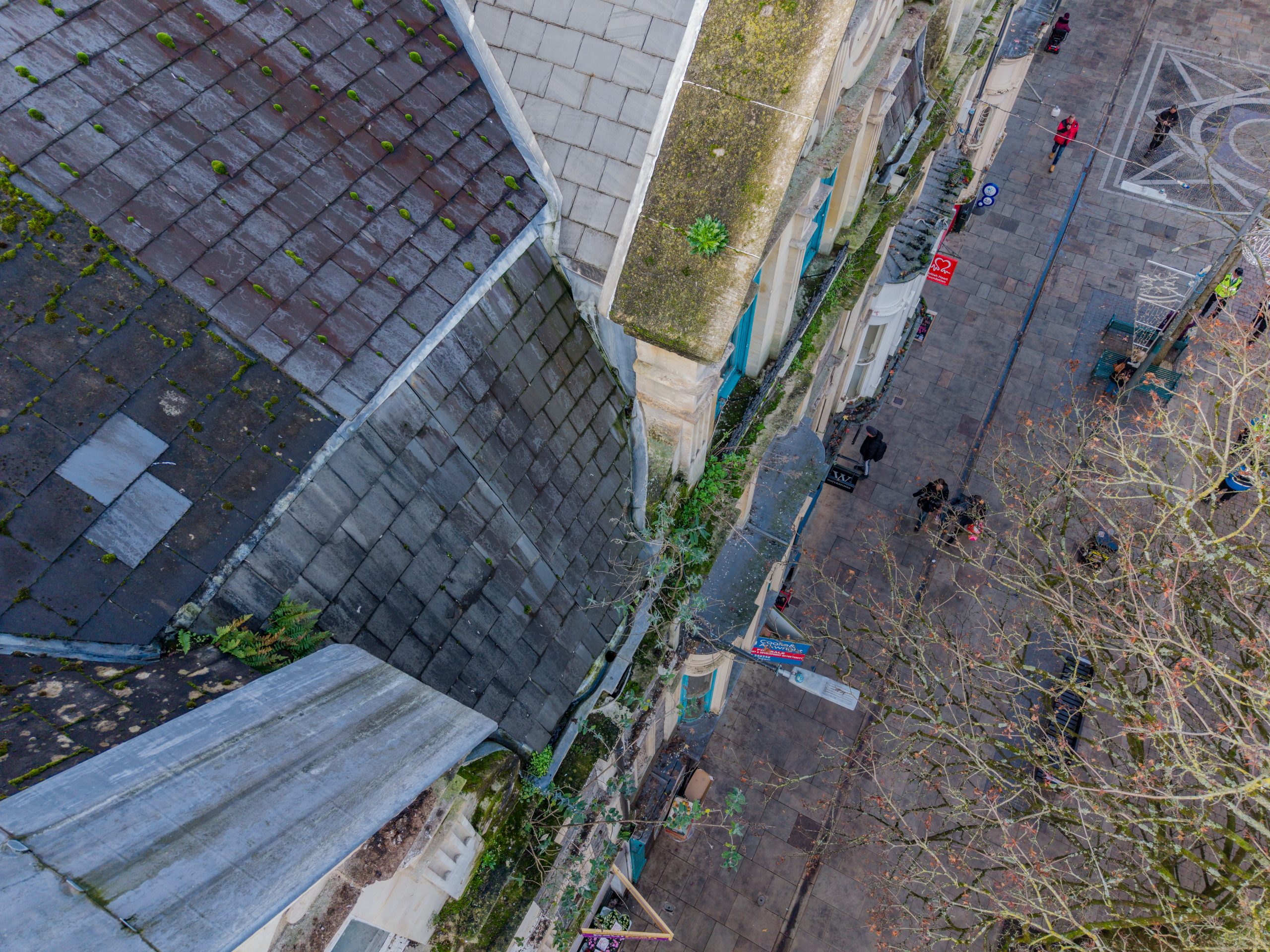
Aerial inspection image showing constrained operating conditions above a busy commercial high street environment.
Why it mattered
The project provided rapid aerial visibility across roof areas that would have been difficult, disruptive or significantly more expensive to access using traditional methods within a busy city centre environment.
By using structured aerial capture, the surveyor team was able to review multiple sections of the property quickly and remotely while maintaining clear visual organisation across the inspection outputs.
The value of the workflow came not just from capturing imagery, but from simplifying access, reducing disruption and delivering practical visual information in a format that could be reviewed efficiently and acted upon quickly.
Need clearer visibility across your site?
If you’re looking for aerial mapping, site documentation or broader operational visibility, feel free to get in touch to discuss what would be useful for your environment or project.