Greencube Storage
Ongoing aerial mapping and site documentation supporting operational visibility and future development planning.
This project focuses on creating clear visual references and site-wide context to support planning, communication and long-term operational understanding.
Project Overview
Greencube Storage required clear aerial visibility across the site to support operational planning, layout understanding and ongoing development over time.
Since the site’s early stages, aerial capture has been used to help visualise yard layout, assess usable space and support planning discussions around operational flow and future positioning of infrastructure and storage areas.
The project has evolved over time to include orthomosaic imagery, terrain and level visualisation, 3D models, stockpile measurements, 360 documentation and repeatable site-wide capture to maintain clarity as the site continues to change and develop.
Using structured aerial capture, the project focused on creating consistent site-wide visuals that could be reviewed easily and referenced over time. The outputs provide a clearer understanding of layout, surrounding context and changing site conditions without relying solely on ground-level perspectives.
Project Type
Mapping & documentation
Environment
Commercial storage site
Outputs
Mapping, models & visual documentation
Status
Ongoing project
Deliverables & Outputs
The project focused on producing clear aerial outputs that could be referenced easily across operational and planning discussions.
Structured aerial capture was used to create site-wide visual context, including orthomosaic mapping outputs and supporting imagery that could be reviewed over time as the site evolves.
The resulting visuals provide a broader understanding of layout, access, surrounding context and site progression that would be difficult to achieve consistently from ground level alone.
Outputs Delivered
- Orthomosaic site imagery
- 3D visual site models
- Terrain and contour visualisation
- Stockpile volume reference measurements
- 360° site documentation
- Repeatable site-wide overview capture
- Aerial and ground-based imagery for planning and communication
Project Visuals
Selected aerial and ground-based visuals captured to support site visibility, planning discussions and broader operational understanding.
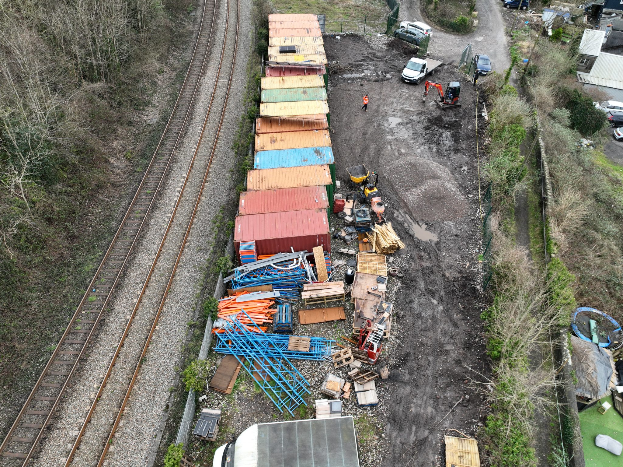
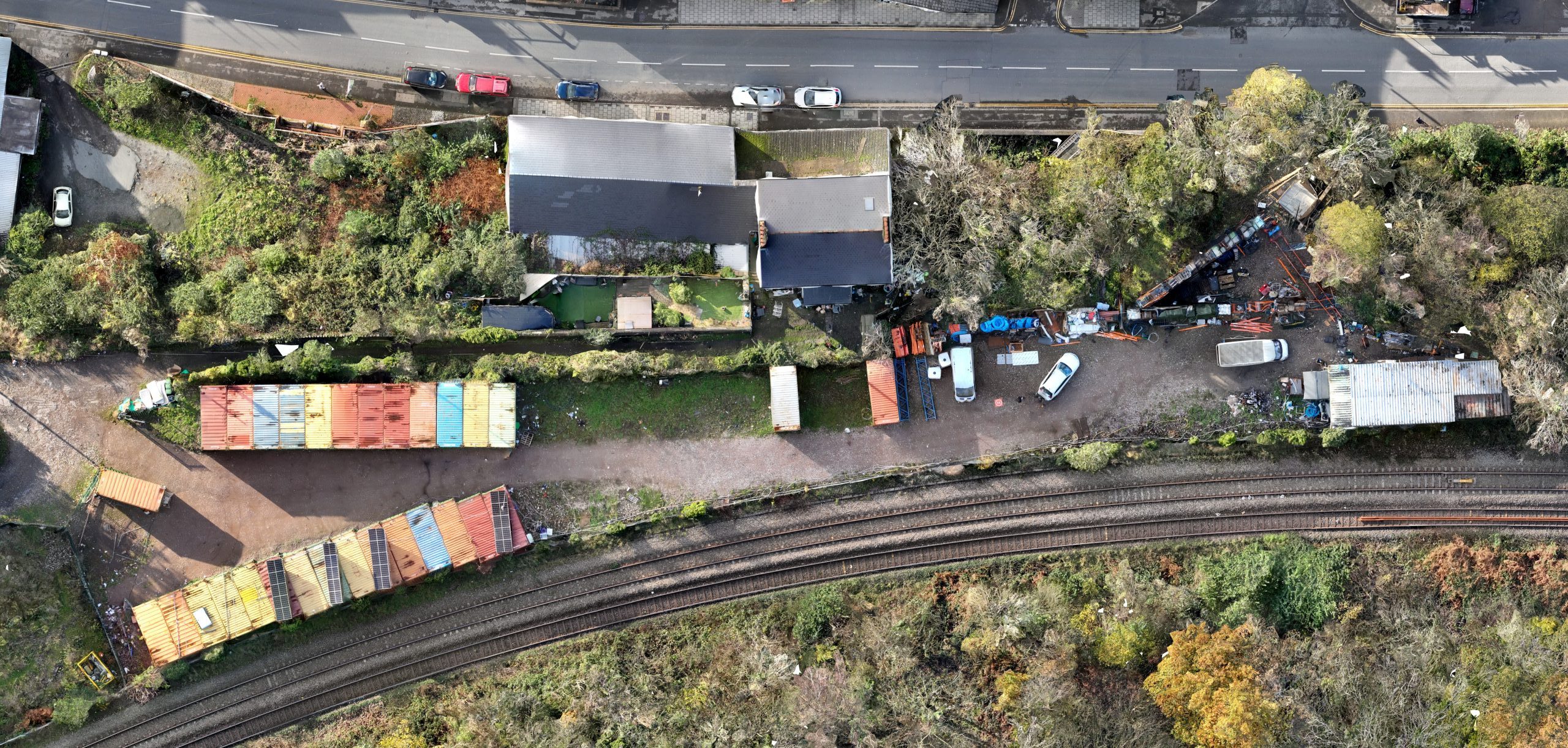
Repeat aerial capture supporting ongoing operational visibility as the site continues to evolve.
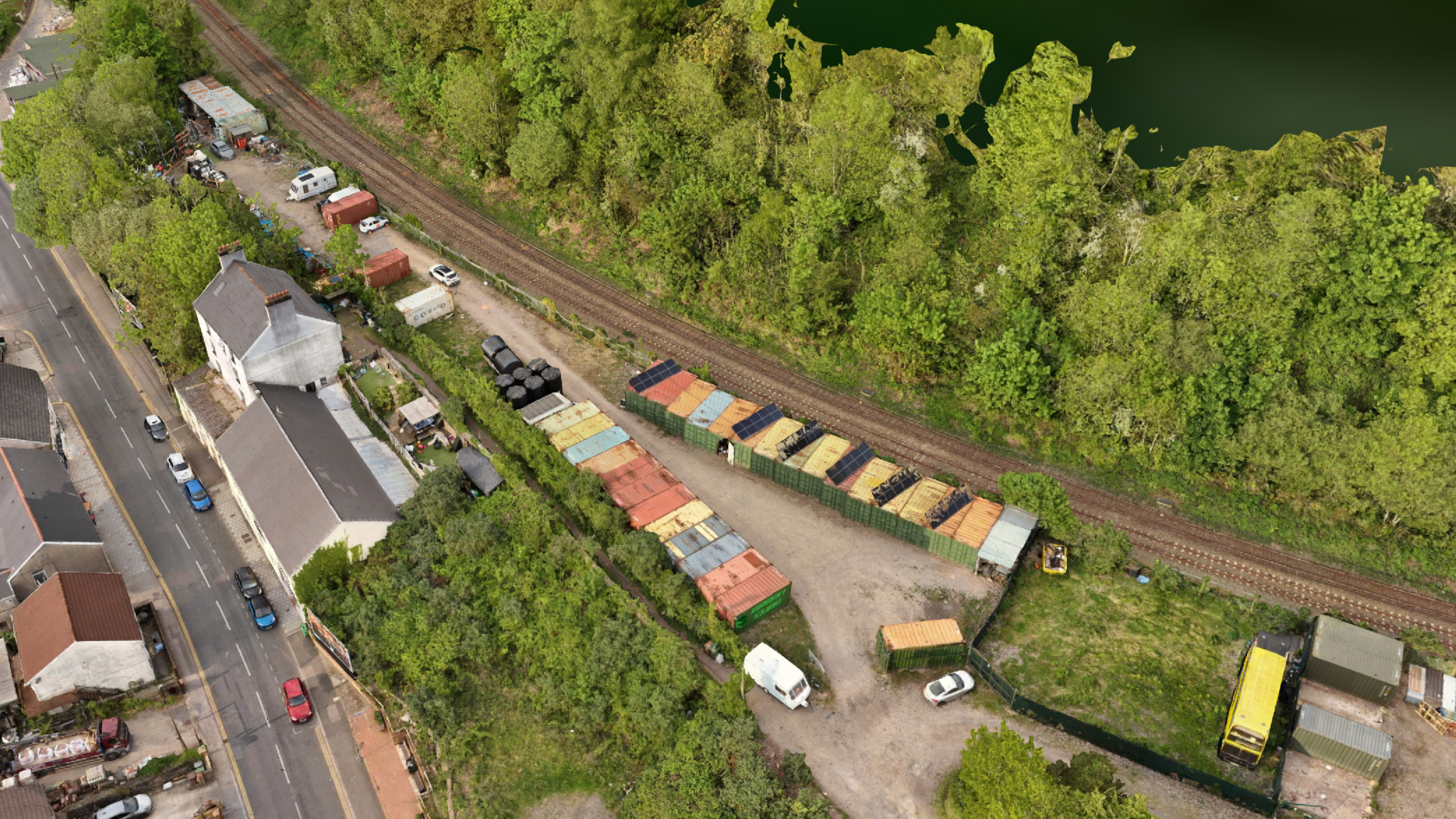
Orthomosaic overview supporting layout understanding and planning visibility across the site.
3D visualisation used to support broader understanding of site structure and elevation changes.
Why it mattered
As the site developed over time, maintaining clear visual understanding across the environment became increasingly important for planning, organisation and operational clarity.
Repeat aerial capture provided a consistent way to review layout changes, monitor site progression and support wider discussions around usable space, infrastructure positioning and future development without relying solely on fragmented ground-level views.
The value of the project comes not just from capturing imagery, but from creating practical visual references that help simplify decision-making, maintain oversight and improve long-term understanding of how the site continues to evolve.
Need clearer visibility across your site?
If you’re looking for aerial mapping, site documentation or broader operational visibility, feel free to get in touch to discuss what would be useful for your environment or project.